
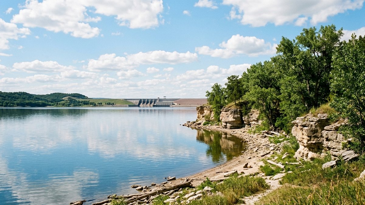
What makes a lake or river property comparable?
A useful comparable sale shares more than a water view. The strongest starting set has a similar setting, nearby market, lot, practical water relationship, condition, and improvements. A house near a lake, a parcel with direct river frontage, and a home that overlooks water can attract different buyers and carry different questions. Treating them as interchangeable can make an asking range look more certain than the evidence supports.
The South Dakota Real Estate Commission explains that an appraisal can use comparison with recently sold properties to estimate value. That does not create one automatic formula for every waterfront home. It does point to a sensible discipline: begin with real closed sales, then describe the differences that a buyer can see and evaluate. Lot configuration, grade, outbuildings, utilities, condition, and the actual access arrangement can matter as much as the word waterfront in a listing.
Keep the local search focused. The Yankton community guide and the acreages page can help a reader explore Southeast South Dakota property types, but the asking range for one parcel still needs a file built around that parcel. A listing professional can explain why a sale belongs in the comparison and where it falls short. That gives buyers a clearer basis for weighing the list price against the property in front of them.
Which water-related facts belong beside the asking price?
The price conversation is easier when the water-related facts are separate from the marketing language. A feature sheet can identify whether the property has frontage, a view, an access point, a dock or shore facility, or nearby public recreation. It can also identify what is documented and what still needs a parcel-specific answer. That distinction keeps a broad statement about lake living from being mistaken for a private property right.
South Dakota’s residential property condition disclosure form asks about easements, boundary concerns, covenants or restrictions, water that has stood in the yard, floodplain location, and federally protected wetlands. The form reflects the seller’s knowledge and is not a warranty or a substitute for inspections. Those categories are useful prompts when assembling a property file because they identify facts that can change how a buyer understands access, use, maintenance, and risk.
For a property near Yankton or Lewis and Clark Lake, the U.S. Army Corps of Engineers describes public recreation areas and shoreline access in the region. That is local context, not proof that a private parcel includes a particular right or facility. Surveys, recorded documents, title work, managing-agency information, and qualified property professionals can clarify the facts for the parcel. The Yankton waterfront guide provides more context for buyers considering that setting.
How do flood maps and tax records fit into pricing?
Flood-map context belongs in the property file before a buyer has to guess what a location near water means. FEMA identifies its Map Service Center as the official source for National Flood Insurance Program flood-hazard information. A map result can help frame a conversation about the parcel, but it is not a substitute for property-specific insurance, elevation, permitting, title, or contract answers. Those questions belong with the professionals and agencies that handle them.
Property-tax information belongs in the file too, but it has a different job. The South Dakota Department of Revenue explains that the state property-tax system establishes full and true value for assessment purposes and then uses taxable value and local levies to calculate tax. An assessed value can help a seller or buyer locate tax records and understand the tax context. It is not a replacement for the closed-sale evidence used to support an asking range.
This difference is practical. A list price explains how the home compares with the available market evidence. A tax bill explains a local tax obligation. A flood map identifies a source for hazard information. Each can matter in a sale conversation, but none answers the other two questions. Keeping the documents separate makes the listing clearer and avoids loading one number with more meaning than it has.
How can a seller present access without overstating it?
Present access as a documented property fact, not a shortcut for value. Start with the physical description: frontage, view, slope, path, boat ramp, shared route, dock, or shore improvement. Then attach the records that explain the legal or practical status of that feature. A survey, recorded easement, title document, permit, or managing-agency guidance can answer a different question than a photo.
That approach also helps a seller separate nearby amenities from private rights. The Corps describes Lewis and Clark Lake as a major regional recreation resource with public recreation areas, boating, fishing, and shoreline access. A home near that resource can be described by its location and the verified details of the parcel. The public lake description does not establish that every nearby home has the same access, dock arrangement, shoreline control, or use option.
The same restraint strengthens the pricing conversation. Buyers can see which features are part of the parcel, which are public amenities, and which items need a current professional answer. That makes the asking price easier to evaluate because the buyer is not being asked to infer a premium from a vague phrase. For the broader listing conversation, pricing Southeast South Dakota homes for relocation buyers offers related market-planning context.
What belongs in a waterfront pricing file?
A pricing file gives the listing conversation a repeatable structure. It does not set a guaranteed price or remove the need for a property-specific review. It does help separate the evidence that supports an asking range from the facts a buyer may need to evaluate before making an offer.
| Item | What it helps explain |
|---|---|
| Recent closed sales | How similar properties were described and where the subject property differs |
| Feature sheet | Water relationship, access details, lot, utilities, condition, and improvements |
| Disclosure and property records | Known condition, boundaries, easements, restrictions, and water-related questions |
| FEMA map reference | Official flood-hazard information to review for the specific location |
| Tax record | Current property-tax context, separate from market pricing |
Start with the comparisons, then test each claimed advantage against the feature sheet and records. A private access feature with clear documentation may deserve a different conversation from a view across public land or a water-adjacent lot with unresolved questions. The file also gives the seller a place to record what is known, what is disclosed, and which points belong with a surveyor, title professional, inspector, insurer, lender, or managing agency. That is more useful than trying to turn every waterfront detail into a marketing claim.
How can the price be tested before offer review?
Test the asking range against the buyer questions that are most likely to matter. Can the comparison set explain the property’s water setting and access? Does the feature sheet distinguish a verified private feature from a nearby public amenity? Are the disclosure, tax, survey, title, and flood-map questions organized well enough for the appropriate professional to review? If the answer is unclear, the price conversation may need more support before it becomes a negotiation issue.
This is also a useful way to compare competing offers. The highest number does not remove the need to understand inspection, appraisal, financing, possession, disclosure, and property-record questions. A seller can ask a South Dakota real-estate professional to explain the market and contract side of the offers, while the relevant specialist can address the details in their own field. The goal is a clear decision with the available information, not a prediction about how any buyer or lender will respond.
For people planning a move alongside a sale, the South Dakota relocation guide can keep the household timeline visible. If you are considering a lake, river, or acreage property in Southeast South Dakota, contact Move to SoDak to discuss the real-estate side of the search or sale. Bring the parcel records and the questions that matter most so the comparison begins with the actual property.
Frequently asked questions
Does a water view make every Southeast South Dakota property comparable?
No. A useful comparison considers the water setting, practical access, lot, condition, improvements, and the nearby market. A view, direct frontage, and documented access are different property facts.
Is the assessed value the same as a list price?
No. South Dakota's assessed value is part of the property-tax system. Recent comparable sales and the property's documented features are separate inputs for a market-price discussion.
Where can a buyer review flood-hazard information?
FEMA identifies the Flood Map Service Center as the official source for National Flood Insurance Program flood-hazard information. Property-specific questions may also require help from the appropriate professionals or agencies.
Do public lake amenities establish private waterfront rights?
No. Public recreation access describes the public resource. A private parcel's access, easements, facilities, and shoreline use depend on its own records and applicable rules.
Sources South Dakota Real Estate Commission: Consumer Information · South Dakota Legislature: SDCL 43-4-44 Property Condition Disclosure Statement · FEMA: Flood Map Service Center products and tools · South Dakota Department of Revenue: Property Tax · U.S. Army Corps of Engineers: Gavins Point Recreation Areas
Related South Dakota resources

Work with Michelle Maloney
Bring Michelle the town, property type, timeline, and the decision you are stuck on. She will help you compare Sioux Falls, Vermillion, Yankton, Tea, Beresford, Elk Point, and the Sioux City corridor against the way you actually need to live or sell.